Description
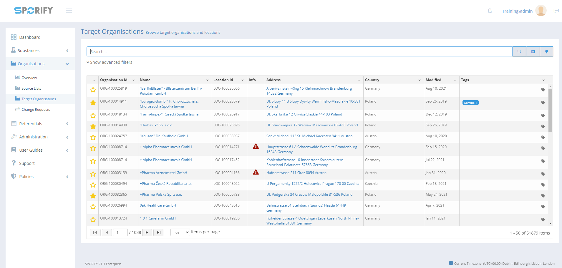
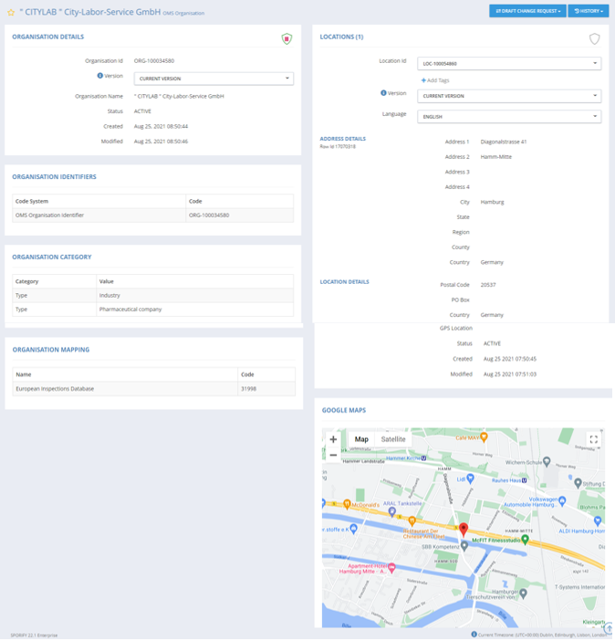
In SPORIFY, the user can access a details page for each Target Organisation. The following information is provided on this details page:
-
Organisation Details
-
Organisation Identifiers
-
Organisation Category
-
Organisation Mapping
-
Locations
-
Google Maps
-
Location Identifiers
Procedure
-
Login to SPORIFY.
-
Select Organisations on the navigation menu.
-
Select Target Organisations.
-
Click on the link in the Name column for the relevant Organisation.
-
The following sections are presented on the details page:
-
Organisation Details
-
Organisation Id
-
Version
-
Organisation Name
-
Status
-
Created
-
Modified
-
-
Organisation Identifiers
-
Code System
-
Code
-
-
Organisation Category
-
Category
-
Value
-
-
Organisation Mapping
-
Name
-
Code
-
-
Locations
-
Location Id
-
Version
-
Language
-
Address Details
-
Location Details
-
-
Google Maps
-
Location Identifiers
-
Code System
-
Code
-
-
Acceptance Criteria
To succeed, the user must be able to view Target Organisations details pages.
-
Verify that Target Organisations details pages can be accessed via Name column links on the Target Organisations grid.
-
Verify that the following areas are presented on the Target Organisations details page: Organisation Details, Organisation Identifiers, Organisation Category, Organisation Mapping, Locations, Google Maps and Location Identifiers.
Related / Alternative Procedure
N/A
GUI Specification
Purpose of this screen.
The purpose of this screen is to provide detailed information to the user relating to a given Target Organisation.
Mockups and Screenshots
GUI Elements
|
Mockup of GUI Element |
Title |
Default |
Enabled |
Type |
Data |
Description |
|---|---|---|---|---|---|---|

|
Version |
CURRENT VERSION |
Always |
Drop-down menu |
String |
Version options presented in the Organisation Details and Locations area |

|
Location Id
|
Primary location
|
Always
|
Drop-down menu
|
String
|
Location Id options presented in the Locations area
|
|
|
Add Tags |
N/A |
Always |
Input field |
String |
Allows the user to add tags to a location in the Locations area |
|
|
Language |
ENGLISH |
Always |
Drop-down menu |
String |
Language options presented in the Locations area |
Available Actions And Commands
|
Mockup of GUI Element |
Title |
Shortcut |
Enabled |
Type |
Role/Permission |
Action |
Tooltip |
Audit Trail |
|---|---|---|---|---|---|---|---|---|
|
|
Zoom |
N/A |
Always |
Buttons |
Target Organisations |
Zooms in and out of map |
N/A |
No
|
|
|
Map/Satellite |
N/A |
Always |
Buttons |
Target Organisations |
Toggles between map and satellite view |
N/A |
No |
|
|
Full screen |
N/A |
Always |
Button |
Target Organisations |
Makes map full screen |
N/A |
No |
|
|
Pegman |
N/A |
Always |
Interactive GUI element |
Target Organisations |
Click and drag to access street view |
N/A |
No |
Related Documentation and Sources
-
N/A